
Objects under the protection of UNESCO. UNESCO heritage. Novgorod historical monuments
UNESCO - The United Nations Educational, Scientific and Cultural Organization was created in November 1945.
Among the main five areas of UNESCO's activities, it is worth highlighting the cultural area, which is in charge of a program such as World Heritage, the purpose of which is the preservation of cultural and natural sites that are the heritage of all humanity.
UNESCO World Heritage is the best man-made creations of mankind and unique natural phenomena of historical, cultural and environmental significance.
The UNESCO World Heritage List as of July 2012 includes 962 sites of cultural and natural significance of special universal value from around the world.
The presence in this list of valuable cultural and natural sites of a country contributes not only to its international prestige, but also to economic benefits and the development of tourism.
To be included in this list, an object must meet at least one of ten established evaluation selection criteria (6 cultural and 4 natural criteria). The only object on the UNESCO list that was assessed according to all 6 cultural criteria, among which there is one such as “a masterpiece of human creative genius,” is the Great Wall of China. The wall is a majestic man-made structure, the construction of which has been ongoing since the 3rd century BC. e. up to the 17th century.
UNESCO World Heritage Sites include cities and archaeological sites, castles, palaces and fortresses, cathedrals, temples and abbeys, theaters and museums, islands, valleys and parks, and much more.
Each country in the world is famous for its unique history, culture, architecture and nature, so each of these countries has designated sites for protection. The most famous among cultural sites are: the religious building Stonehenge (Great Britain), the mausoleum-mosque of the Taj Mahal (India), the Moscow Kremlin (Russia), the Pyramids of Giza (Egypt), and among natural ones - Belovezhskaya Pushcha (Poland), Lake Baikal (Russia ), Great Barrier Reef (Australia).
Almost every year, UNESCO holds sessions where members of the World Heritage Committee decide to include a particular site on the list of protected sites. At the last session, which was held in July 2012 in St. Petersburg, the UNESCO World Heritage List included, in particular, such objects as the historical city of Rabat (Morocco), decorations of farm houses in the province of Hälsingland (Sweden), and the natural park " Lena Pillars" (Russia), coastal landscapes of Carioca (Rio de Janeiro, Brazil) and others.
The UNESCO World Heritage Site is a unique opportunity for travelers to get acquainted with outstanding cultural monuments and natural sites of our planet and discover many interesting places that they did not even suspect existed. How many of you have heard or know about such a place as the settlement of Lumbini in Nepal, which is associated with the birth of Gautama Buddha, the founder of Buddhism, or about the “Frankincense Trail” in Oman; about the largest crater in the world - Vredefort in South Africa, whose age is estimated at 2 billion years, or about the monastery of St. Gall in Switzerland, whose library is one of the oldest and richest in the world and stores precious ancient manuscripts.
Therefore, if you want to spend your holidays in any country, look at photographs of the best creations of mankind and nature. Maybe you want to visit the Acropolis of Athens or the legendary Palace of Knossos, then you should consider a tour to Greece. Or maybe you want to go to Greenland and visit the Ilulissat Fjord to watch giant icebergs drifting, or visit the caves and enjoy the fantastic scenery of Ha Long Bay, located in Vietnam.
On our website you can get acquainted with both unique World Heritage sites and other interesting places, natural and cultural attractions of different countries, which will help you in planning tourist routes and will serve as a good guide on your trip. Have a nice trip!
World Heritage refers to various natural or man-made sites that should be preserved for future generations because of their special cultural, historical or environmental significance. As of 2012, there are 962 points on this list, 754 of them are cultural monuments, 188 are natural and 29 are mixed.
UNESCO was established in 1945 and its purpose is to protect and preserve places of special value or physical significance for all mankind. In 1954, during the construction of the Aswan Dam, Abu Simbel, a man-made temple carved into the rock, was flooded. The responsible organization allocated money so that the structure could be dismantled and moved to a higher place. This unprecedented action took four years, and highly qualified specialists from 54 countries were involved in its implementation in a short time.
Today on the pages of Forum-Grad we will discuss a rather interesting topic - the UNESCO World Heritage List.
Aldabra Atoll
The atoll consists entirely of corals and is a group of four islands separated by narrow straits. It is located north of Madagascar in the Indian Ocean. Belongs to the state of Seychelles.
Aldabra is considered the second largest in the world after Christmas Island (Kiritimati) in the Kiribati archipelago. Its dimensions are: 34 km long and 14.5 km long, height above sea level up to 8 m. The area of the internal lagoon is 224 sq. m. km.
Since the 17th century, it was used by the French to hunt giant sea turtles, as their meat was considered an exquisite delicacy. For a long time, pirates also ruled these places, because the atoll is located far from populated areas.
In 1982, this piece of paradise was included in the UNESCO World Heritage List as a unique natural monument. This is one of the few islands on our planet that has not been touched by civilization. Currently, it is home to a huge population of giant sea turtles (more than 152 thousand) and two completely unique species of bats. Entry into this nature reserve is strictly controlled, and all approaches by sea are guarded.
Giant statue in China
The huge Maitreya Buddha is carved into a rock at the confluence of three rivers - Minjiang, Qingyijiang and Daduhe near the city of Leshan in China. According to ancient legend, a famous monk named Haithong of the Tang Dynasty, worried about the frequent shipwrecks and deaths of people in the whirlpool just opposite this rock, vowed to carve a stone statue of a seated Buddha. He raised funds and began construction, and his followers completed the work. The largest monument in the world was built over 90 years - from 713 to 803.
For the convenience of visitors, a special path “Nine Turns” was built here, consisting of 250 steps. Next to the path there is a pavilion where tourists can relax and admire the face of the giant up close.
Almost until the middle of the 13th century, a huge seven-story wooden structure protected the statue from the weather, but over time it collapsed, and the structure remained defenseless against the natural elements. Garbage left by tourists began to accumulate at the foot, and the waters of three rivers washed away the base in the shape of a lotus.
The local department hired 40 workers to restore the unique statue to its former glory. About $700,000 was invested in the project and another $730,000 was invested in improving security systems.
Every year, more than 2 million travelers from all over the world come to see the seated Buddha and add about $84 million to the budget of the Leshan tourism department.
Hatra, or El-Khadr
This is an ancient destroyed city as part of the Parthian kingdom, the ruins of which are still located in Northern Iraq in the province of Nineveh, northwest of the country's capital, Baghdad. It was founded in the 3rd century, and its heyday occurred in the 2nd-1st centuries BC.
The total area was about 320 hectares, in shape it resembled an oval, surrounded by a double line of high stone walls with four gates oriented to the cardinal points. The most powerful defensive wall, two meters high, was made of stone, behind which there was a deep ditch up to 500 meters wide. There were 163 defensive towers at a distance of 35 meters from each other.
The city belonged to the Arab princes, who regularly paid tribute to the warlike Persians, and was located at the crossroads of the main trade routes of that time. In the center there was a palace and temple complex with an area of about 12,000 square meters. meters. Due to its transit location, El-Khadr included religious buildings of different directions; it was even called the “House of God.”
Thanks to good defensive structures and vigilant round-the-clock security, the ancient city withstood even the attacks of the legionnaires of the Roman Empire in 116 and 198 AD, but in 241 Hatra fell under siege by the Persian ruler Shapur and was soon destroyed and consigned to oblivion.
House Schröder by Gerrit Thomas Rietveld
This house was specially built in 1924 for the 35-year-old widow Truus Schröder-Schrader and her three children in the small Dutch town of Utrecht. The building is distinguished by innovative solutions in the original and unusual for those times exterior design, as well as the appearance of spacious balconies and huge windows.
The project and the entire internal layout were developed by the novice architect Gerrit Thomas Rietveld. The widow proposed a number of unusual innovations, which it was also decided to implement. So, an elevator was built in the kitchen on the ground floor, in which ready-made dishes were served upstairs directly to the set table. All the interiors of the first level are quite traditional for that time. The walls are made of antique bricks.
But on the second floor, according to the owner of the house, the entire space remained completely open, and it can be divided into several rooms at any time using sliding walls. All wardrobes and beds are transformable, assembled during the day and unfolded at night. Instead of the usual curtains, like all the neighbors, multi-colored plywood panels were used.
Currently, the unique house belongs to the Central Museum of Utrecht and there are guided tours that take about an hour.
This building is included in the UNESCO World Heritage List because it had a significant influence on further architectural trends, and also became the first open-plan house in the world history of architecture.
Krak des Chevaliers
Krak des Chevaliers (or Krak de l'Hospital) is a unique crusader structure located in the state of Syria on the top of a cliff 650 meters high. The nearest city of Homs is 65 km east of the castle.
This is one of the well-preserved fortresses of the Order of Hospitallers in the world. In the 10th century, this castle became his headquarters, where during the crusade a garrison of 2,000 soldiers and 60 knights could be accommodated.
In addition to the powerful walls, many buildings in the Gothic style were reconstructed and restored. These included a large conference hall, water storage tanks, a chapel, an internal aqueduct, storage areas and two stables that could house up to 1,000 horses. In the rock mass under the building there were underground storage facilities for food and water supplies, which could have been enough during a long siege for 5 years.
At the end of the 12th century, during the next crusade, King Edward I of England saw the impregnable fortress, and soon his castles appeared in Wales and England, very similar in structure to Krak.
Monastery of Alcobaça
The Cistercian monastery “de Santa Maria de Alcobaça”, located in the Portuguese city of Alcobaça, was founded by King Afonso Henriques in 1153 and for two centuries served as a tomb for the rulers of Portugal. The cathedral is the first building in the Gothic style built on the territory of the ancient state.
Architecture is historically valuable. The two wings of the main facade are made in the Baroque style, and between them there is a church, the facade of which seems to connect these two directions. At the top there is a balcony supported by four statues - they symbolize the main virtues: justice, fortitude, prudence and sobriety.
In 1755, the whole country was shaken by the great Lisbon Earthquake, which was very destructive, but the temple survived - only the sacristy and part of the service buildings were damaged. However, the original appearance of the historical place could not be restored. Near the entrance to the church is the Hall of the Kings, where there are statues of all the monarchs of Portugal, and the history of this place is written on the walls using blue and white azulejos tiles from the 18th century.
After viewing this masterpiece of early Gothic architecture, other interiors of famous cathedrals in Europe seem gloomy and not so aesthetic. These buildings demonstrate the perfect skills and dedication of medieval craftsmen. And the entire ensemble of “de Santa Maria de Alcobaça” is one of the most beautiful monuments of Portuguese art.
Monte Alban
According to prominent world-famous scientists, this is a fairly large settlement of ancient people in the southeast of Mexico, the state of Oaxaca. Just 9 km from the state capital, on a low ridge of a mountain range passing through the valley, lies a man-made plateau. It was the site of the very first city in the entire historical region, which played a significant role as the socio-political and economic center of the Zapotec civilization.
In the early 30s, the ruins of this ancient settlement were discovered by the Mexican archaeologist Alfonso Caso. Many pundits equate this discovery to the sensational discovery of the true location of the legendary Troy.
“Mexican Troy” turned out to be a city of high culture; local craftsmen could already process rock crystal and make unique gold jewelry back in 200 BC.
During the excavations, 150 four-chamber crypts, palaces and pyramids very similar to those built by the Mayans, an ancient observatory, a giant amphitheater with 120 rows for spectators, powerful stone stairs 40 meters wide, a structure resembling a stadium and much more were discovered.
The walls of the buildings are decorated with frescoes, relief images of human figures and stone mosaics. Original funeral ceramic urns in the form of gods and various animals were discovered.
The impressive ruins of the center of the ancient civilization of Monte Alban are located in such a way that they are visible from anywhere in the central Oaxaca Valley
Lalibela
It is a small town in northern Ethiopia, located in the Ahmara region at an altitude of 2500 meters above sea level. It is a center of pilgrimage for the entire population of the country, because almost all the residents of the town are Christians of the Ethiopian Orthodox Church.
Lalibela was built as the New Jerusalem in response to the Muslim takeover of the Christian holy site in the State of Israel, so many historical buildings have names and architecture similar to the ancient buildings of Jerusalem.
According to 2005 data, the city's population was 15 thousand people, most of whom (about 8,000) were women. This medieval religious center is famous for its monolithic, three-nave churches carved into volcanic tuff, built at the turn of the 11th - 13th centuries. The bas-reliefs and wall paintings of these ancient structures mix Christian and pagan symbols and motifs.
Thirteen temples seem to grow out of the ground. “Bete Mariam” is considered the oldest, and “Bete Medhane Aleyem” is the largest church in the world, carved into the rock. According to legend, the ashes of King Lalibela rest in the last of the rock-cut churches, Bete Golgotha.
These unique works of architecture by ancient craftsmen are also monuments of the engineering thought of medieval Ethiopia - near many of them there are wells that are filled with water using a complex system based on the use of artesian wells.
Eight hundred years ago people could supply water to a height of 2500 meters!
Ellora
It is a simple village in the state of Maharashtra, India, near the city of Aurangabad. It is famous for the fact that nearby cave temples of different religions are carved into the rocks, the creation of which dates back to the 6th – 9th centuries of the new era. Of the 34 caves in Ellora, 12 in the south are Buddhist, 17 in the center are dedicated to Hindu gods, and 5 to the north are Jain.
Most of the ancient shrines have their own names, the most famous is “Kailas”. This beautiful, perfectly preserved example of ancient architecture is considered one of the most precious monuments in India. In the granite canopy above the entrance to this place, sacred to all Hindus, colossal statues of Shiva, Vishnu and other gods revered in the country are carved.
Next comes the huge goddess Lakshmi - she reclines on lotus flowers, and majestic elephants stand around. On all sides the temple is surrounded by monumental lions and vultures, they are frozen in different poses, and guard the peace of the heavenly kings.
One of the legends says that this piece of paradise was built by one Rajah - Edu of Elichpur - in gratitude for healing with water from a spring located on the territory of the temple.
Vishvakarma has a multi-storey entrance and a large hall in which there is a sculpture of Buddha giving a sermon.
"Indra Sabha" is a two-level monolithic Jain temple.
"Kailasanatha" is the central place of the entire sacred complex, and during the construction of this miracle in the town of Ellora, more than 200,000 tons of rock were removed.
Ancient Building Complex in Wudang Mountains
The Wudang Mountains in China are famous for their ancient monasteries and temples. Once upon a time, a university was founded here to study medicine, pharmacology, nutrition, meditation and martial arts.
Back during the Tang Dynasty (618-907), the first religious center was opened in this area - the Temple of the Five Dragons. Major construction on the mountain began in the 15th century, when the Yongle Emperor summoned 300 thousand soldiers and built complexes. At that time, 9 monasteries, 36 hermitages and 72 shrines, many gazebos, bridges and multi-tiered pagodas were built, forming 33 architectural ensembles. Construction lasted 12 years, and the complex of structures covered the main peak and 72 small peaks - the length was 80 km.
The “Golden Hall” is one of the most famous; its production required 20 thousand tons of copper and about 300 kg of gold. According to scientists, it was forged in the capital of China, Beijing, and then transported piece by piece to the Wudang Mountains.
The Purple Cloud Temple consists of several halls – “Dragon and Tiger Hall”, “Purple Sky Hall”, “East”, “West” and “Parent”. The shrines of Wu Zhen have been kept here since its founding.
During the troubled times of the Cultural Revolution in China (1966-1976), many places of worship were destroyed, but later restored, and now the complex is visited by tourists from all over the world.
The architecture of the ancient Wudang Mountains complex combines the best achievements of Chinese traditions over the past fifteen hundred years.
"Valley of the Whale" in Egypt
40 million years ago, “Wadi Al-Hitan” was the bottom of the World Ocean, which is why hundreds of skeletons of ancient mammals were preserved here. This unique valley is located 150 km southwest of the capital of Egypt - Cairo. Many whale remains belong to the extinct suborder Archaeoceti, representing one of the most important stages of evolution: the degeneration of terrestrial multi-ton monsters into marine mammals.
Fossil skeletons clearly show the appearance and lifestyle of these giants during their transitional period. In addition, they are all located in an area convenient for study and, importantly, vigilantly guarded.
In addition, there are remains of sea cows "Sirenia" and elephant seals "Moeritherium", as well as prehistoric crocodiles, sea snakes and turtles. Some specimens are so well preserved that the contents of their large stomachs can be studied.
All together helps scientists unravel the still existing mystery of the evolution of these largest mammals on the planet.
Pristine exotic tropical forests
Kerchin-Seblat National Park is the largest nature reserve on the island of Sumatra, its area is about 13.7 thousand square meters. km. Here you can see more than 4,000 species of plants, including the world's largest flower - Rafflesia Arnolda, its diameter is 60-100 cm, and its weight reaches up to 8 kg. In addition, this area is home to about 370 species of birds and rare animals (Sumatran tigers, elephants and rhinoceroses, Malayan tapir). There are also hot springs, the highest caldera lake and the highest peak on the island. And recently a muntjac deer was seen here, a species that was considered extinct back in the 30s of the last century.
The second largest is Gunung Löser, with an area of 7927 square meters. km. Located in the Aceh region and around the town of Bukit Lawang. This small town is considered the best starting point for exploring an exotic place. Tours are only permitted with a trained guide and special permission.
The most interesting thing in this reserve is the large population of great apes - orangutans. Translated from Malay, it means “forest man”.
The third largest is Bukit Barisan Selatan with an area of 3,568 square meters. km, covering the provinces of Lampung, Bengkulu and South Sumatra. Here you can find very rare animals - the Sumatran elephant and the striped rabbit.
Tourists value Sumatra for its tropical forests with preserved nature in its original form, for its strange plants and amazing representatives of exotic fauna. In addition, there are many beautiful and still active volcanoes.
"The Sistine Chapel of Primitive Painting"
“Lascaux” is located in France, 40 km from the city of Périgueux and is considered one of the most important Paleolithic monuments in terms of the quantity, quality and preservation of ancient cave paintings. The cave was discovered by chance in 1940 by four teenagers who noticed a narrow hole in the rock caused by a falling tree. After examination, scientists determined that the age of the rock paintings is more than 17,300 years.
The cave is quite small in size, the totality of all its galleries is about 250 meters, and the average height is 30 meters. Visitors were allowed in from 1948 to 1955, but then it was closed because the ventilation systems could not cope with the carbon dioxide that accumulated inside from the breath of numerous tourists, and the rock paintings could be damaged.
Air conditioning systems were changed several times in the last century, but they were all ineffective, and the historical heritage was periodically closed for maintenance work. And only in the 21st century were powerful units installed that successfully coped with the task.
To preserve the wall paintings, they decided to copy all the images and made a concrete copy, where almost all the rock paintings are presented in the same sequence as the original. The cave was called “Lascaux II”, it is located only 200 meters from the present one and was first opened to travelers in 1983.
Takht-e Jamshid
Takht-e Jamshid in Greek “Persepoles” is the ruins of the capital of the Achaemenid Empire. This place is considered one of the most beautiful monuments in the history of the state of Iran. It is located on the Marvdasht plain at the foot of Mount Ramhat and was founded by the Great Persian King Darius I in 515 BC.
The area of this stone structure is 135 thousand square meters. meters, it includes the “Gateway of All Nations”, “Apadana Palace”, “Throne Room”, the tomb of the “King of Kings”, an unfinished palace and a treasury. Construction lasted about 45 years and was completed during the reign of Xerxes the Great, the eldest son of Darius.
In Persepolis, mainly the remains of the palace complex and religious buildings have been preserved. The most famous of them is "Apadana" with a ceremonial hall and 72 columns. Five kilometers away is the royal tomb of Naqshe-Rustam and the rock reliefs of Naqshe-Rustam and Naqshe-Rajab.
Here in those distant times there already existed water supply and sewerage, and slave labor was not used during construction. The walls of this unique complex were more than five meters thick and up to 150 centimeters high. One could ascend to the city via the grand staircase, consisting of two flights of 111 steps each made of white limestone. Then it was necessary to pass the “Gate of All Nations”.
But the powerful walls did not help, and in 330 the great conqueror Alexander the Great stormed the fortified complex and, during a feast in honor of the victory, burned the capital of the Persian kingdom to the ground, perhaps in retaliation for the Acropolis destroyed by the Persians in Athens.
Cradle of Humanity
The historical monument is located 50 km northwest of Johannesburg in the Gauteng province of South Africa in the south of the African continent. Its area is 474 square meters. km, the complex includes limestone caves, including a group called Sterkfontein, where in 1947 Robert Bloom and John Robinson discovered the fossil remains of an ancient man - "Australopithecus africanus" aged 2.3 million years.
"Taung Rock Fossil Site" - it was here that the famous Taung skull, belonging to an ancient man, was discovered in 1924. The Macapan Valley is famous for the abundance of archaeological traces found in the local caves, confirming the existence of people about 3.3 million years ago.
Fossils discovered here have helped scientists identify ancient hominid specimens dating back to between 4.5 and 2.5 million years ago. These same finds fully confirm the theory that our distant ancestors began to use fire about a million years ago.
Perhaps some of the readers will think that our topic contains a lot of numbers, but this is the story, and not of any individual person, but of our entire civilization.


Ten natural sites of the Russian Federation are on the UNESCO World Heritage List (4 of them are recognized as natural phenomena of exceptional beauty and aesthetic importance), and this is not counting another 15 sites that are cultural objects of protection. This is not at all surprising, because Russia is a truly vast country, with a vast territory, incredibly beautiful and diverse nature, and a rich cultural heritage.
If you want to see the pristine nature of Russia in its pristine form, then Russians (and foreign tourists too) will have no difficulty going to one of the country’s natural reserves or national parks, on the territory of which these ten objects that need constant international protection are located level...
1. Forests of the Komi Republic
The area of these forests is more than 3 million hectares, on which a national park and a state biosphere reserve are located. This facility opened a new page for Russia in environmental protection at the global level.

The virgin forests of Komi are known as the largest intact forests growing in Europe. They occupy an area of 32,600 square kilometers in the north of the Ural Mountains, within the Pechero-Ilychsky Nature Reserve and the Yugyd Va National Park. In terms of their composition, Komi forests belong to the taiga ecosystem. They are dominated by coniferous trees. The western part of the forests is in the foothills area, the eastern part is in the mountains themselves. The Komi forest is distinguished by the diversity of not only flora, but also fauna. More than two hundred species of birds live here, There are 40 species of rare mammals, and the reservoirs are home to 16 species of fish, which are considered valuable for fishing, preserved from the Ice Age. For example, such fish species include Siberian grayling and palia char. Many inhabitants of the virgin forests of Komi are listed in the Red Book of the Planet. This natural site of the Russian Federation was included in the UNESCO list in 1995 - the very first on the list.
2. Lake Baikal

For the whole world, Baikal is a lake, for the residents of Russia, who are in love with a unique natural object, Baikal is a sea! Located in Eastern Siberia, it is the deepest lake on the planet and, at the same time, the largest natural reservoir of fresh water by volume. The shape of Baikal looks like a crescent. The maximum depth of the lake is 1642 meters with an average depth of 744. Baikal contains 19 percent of all fresh water on the planet. The lake is fed by more than three hundred rivers and streams. Baikal water has a high oxygen content. Its temperature rarely exceeds plus 8-9 degrees Celsius even in summer in the surface area. The water of the lake is so clean and transparent that it allows you to see at a depth of up to forty meters.

Lake Baikal, the oldest and deepest (approximately 1,700 meters) on Earth, covers an area of over three million hectares. The reservoir, which appeared about 25 million years ago, was in almost complete isolation, thanks to which an amazing ecosystem was formed in its fresh waters, the study of which allows us to obtain information about the evolutionary processes taking place on the planet.
Unique even on a global scale, the lake contains about 20% of all available reserves of essential fresh water on Earth, as well as a delightful spectacle, inspiring with beauty and captivating with the luxury of amazing landscapes.
Lake Baikal was named a beautiful pearl by UNESCO in 1996 and included in the list of priceless heritages of the planet.
3. Kamchatka volcanoes .

This site was also included in the World Heritage List in 1996. Five years later (in 2001), the territory of the object subject to international protection expanded due to the movement of lithospheric plates of the Pacific volcanic ring. Today, the territory of the state biosphere reserve is about 4 million hectares. This area is called the “natural museum of volcanology.” Both long-extinct and active volcanoes of the Kamchatka Peninsula can serve as exhibits. Moreover, each of the “exhibits” is an individual object, for which a lifetime would not be enough to study.
In total, there are currently about 300 extinct volcanoes and 30 active volcanoes on the territory of this object, but the number of the latter changes every year. The most interesting attraction for tourists in this region is the Valley of Geysers in the Konotsky Biosphere Reserve. The mountain rivers of Kamchatka abound with huge numbers of salmon fish, and the coastal waters are home to many species of whales and dolphins.
4. Altai Mountains

These mountains are called “Golden”, since every species of animal, bird and fish here is unique. Altai cedar forests and mammals with the most valuable commercial fur, which can be equated in value with gold, have been preserved here. The site covers an area of more than 1.5 million hectares and was included in the UNESCO list in 1998. The “golden” Altai Mountains are located at the intersection of the mountain systems of Siberia and Central Asia.

The vegetation of this region is unique; there is an abundance of alpine meadows, steppes, semi-deserts and tundra. Absolutely everything is unique here, from snow leopards to mountain landforms. The pearl of the Altai region is called Teletskoye Lake, which is also called “Small Baikal”.
5. Natural Park “Lena Pillars”
The fabulously beautiful landscapes of the park are formed by hundred-meter rock formations that pacify the waters of the beautiful Lena River. The Lena Pillars are located in the very heart of Sakha (Republic of Yakutia).

Such an amazing natural phenomenon owes its appearance to the continental climate, temperature fluctuations within which reach about one hundred degrees (+40 degrees in summer and -60 degrees in winter). The pillars are separated by deep ravines with steep slopes. Their formation occurred under the influence of water, which contributed to soil freezing and weathering. Such processes led to the fact that the ravines deepened and widened. In this case, water plays the role of a destroyer, posing a danger to the pillars.
The Lena Pillars, included in the list of world heritage in 2012, are of interest not only from the point of view of an aesthetic spectacle; it is also a unique archaeological zone, on the territory of which the remains of ancient animals of the Cambrian period were discovered.

This natural site has an area of 1.27 million hectares. If we take into account the geological structure of the soil in the park, then this land can “tell” a lot about the history of the development of the planet, about living organisms and vegetation.
In the Lena Pillars, many remains of mammoths, bison, woolly rhinoceroses, Lena horses, reindeer and other remains of ancient mammals were discovered. Today the complex is home to 12 representatives of animals and birds listed in the Red Book of the Planet. It is believed that the Lena Pillars have a huge “aesthetic influence” on people due to their unique beauty of landscapes, bizarre terrain with huge caves, fabulous-looking stone sculptures, rocky spiers, niches and “towers”.
6. Sikhote-Alin Nature Reserve

This territory, included in the UNESCO list in 2001, covers an area of about 0.4 million hectares. The object is valuable because unique broad-leaved forests and ancient coniferous forests have been preserved on its territory. There is also an incredible mix of flora and fauna, including many rare species.
A large biosphere reserve in the Primorsky Territory was originally created to preserve the sable population. Currently, it represents the most convenient place for observing the life of the Amur tiger. A huge number of plants grow on the territory of the Sikhote-Alin Nature Reserve. More than a thousand higher species, more than a hundred - mosses, about four hundred - lichens, more than six hundred species of algae and more than five hundred - fungi.

The local fauna is represented by a large number of birds, marine invertebrates and insects. Many plants, birds, animals and insects are protected species. Schisandra chinensis,ginseng,rhododendron Fori and edelweiss Palibina, spotted deer and Himalayan bear, black crane and stork, Japanese starling, Sakhalin sturgeon, fish owl and swallowtail butterfly - they all found shelter in the Sikhote-Alin Nature Reserve.
7. Natural complex of the Wrangel Island reserve
The protected area, which was added to the list of UNESCO treasures in 2004, is located beyond the Arctic Circle. It includes the relief landscapes of Wrangel Island, whose area is over 7 thousand square meters. kilometers, and Herald Island, whose area is 11 thousand square meters. kilometers, as well as the coastal waters of the East Siberian Sea and the waters of the Chukchi Sea.
This region managed to avoid glaciation, thanks to which the area is characterized by amazing biological diversity. The harsh climate of the protected area attracted walruses, who formed the largest rookery in the Arctic here. Polar bears have also taken a liking to the picturesque land; the density of their dens in this region is considered to be the highest on the planet.

Over fifty species of birds nest here, some of which are endemic and endangered. Gray whales rush here, choosing this place for feeding. Surprisingly, over four hundred species of vascular plants are found on the island, among which there are also endemics.
Here tourists can see the largest bird colonies in the eastern Arctic. Relics of the Pleistocene predominate among plant forms. The landscape of the island is unusual, as is its water area. Many travelers dream of visiting here.
8. Ubsunur Basin

The area of this unique biosphere reserve is 0.8 million hectares. The object was included in the UNESCO list in 2003. A salt lake with a large area is located on the border of Mongolia and the Russian Republic of Tyva. By the way, on the territory of Russia there are only seven sections of the intermountain basin with a shallow lake (up to 15 meters), the remaining five parts of the Transboundary Site are located in Mongolia. Each of the seven sections of the basin on our territory is individual in appearance and the plants that grow there depending on the landscape.

Inhabitant of the Ubsunur Basin
ZHere you can see foothills with eternal areas of snow-capped peaks, there are also areas of mountain taiga, alpine meadows, wetlands, mountain tundra and even sandy deserts. The remnant mountains with bright vegetation and contrasting landscapes make the Ubsunur basin especially picturesque. Endangered species of animals are found here - mountain sheep - argali, snow leopard, as well as many rare species of birds - geese, herons, terns, gulls, waders, etc. During excavations of ancient mounds on the territory of the basin, unique rock paintings, burials and stone sculptures were discovered .
9. Putorana Plateau

Included in the World Heritage List in 2010, this natural site of the Russian Federation has a total area of more than 1.8 million hectares. This virgin basalt plateau in the north of Eastern Siberia, almost at the Arctic Circle, is invaluable for study by geologists and geomorphologists. The mountainous terrain has a stepped landscape, with flat-topped massifs intersected by deep canyons. The plateau was formed at the boundary of the Mesozoic and Paleozoic as a result of volcanic activity. Forty-layer deposits make it possible to study the structure of the planet.
Deep cracks in the plateau were formed by glaciers, which were subsequently filled with water, forming lakes with a unique appearance and a depth of up to 400 meters. There are many beautiful waterfalls on the plateau, one of which (in the valley of the Kanda River) has a height of 108 meters. In total, on the territory of the Putorana Plateau there are 25 thousand small and large lakes with a huge supply of fresh water. There are more than 30 species of mammals in this northern reserve and all of them are rare or relict.

The vegetation is represented by 400 species - mainly open forest, mountain tundra and larch taiga. The plateau serves as a resting place for thousands of species of migratory birds.
The picturesque landscapes of the beautiful plateau coincide with the boundaries of the reserve of the same name located beyond the Arctic Circle, which adorns the territory of Central Siberia. The changing zones give a special charm to the area: virgin taiga, rich forest-tundra, colorful landscapes of the tundra and the fabulous beauty of the icy Arctic deserts. A real decoration of the plateau: curly ribbons of rivers and a crystal lake saucer filled with clean cold water. A road along which deer migrate runs through the inhospitable lands of the plateau. This is an incredible spectacle, which can be observed less and less in nature.
10. Territories of the Western Caucasus
The natural reserve with an area of 0.3 million hectares has been included in the UNESCO list since 1999. These territories are almost untouched by human civilization. Today they are protected not only by UNESCO, but also by other all-Russian and international organizations - Greenpeace, the Institute of Geography of the Russian Academy of Sciences, NABU, Dresden Technical University, the North Caucasus working group, etc. The territory of the reserve covers areas that stretch from the headwaters of the river Kuban to the Belaya and Malaya Laba rivers..

Caucasus. Blooming rhododendron in the Upper Mzymta valley
The vegetation in this protected region is represented by coniferous and broad-leaved forests, crooked forests, mountain meadows, and the nival belt. Every third plant here is considered relict. Rare species of birds of prey nest here - ospreys, bearded vultures, golden eagles, griffon vultures, etc. Among the large animals in the reserve you can see Western Caucasian tigers, brown bears, wolves, Caucasian red deer, bison, etc. Tourists will be interested in seeing beautiful karst formations in this natural area with deep gorges, waterfalls, underground rivers, tarns, moraines, cirques and valleys formed by mountain glaciers.
11. Curonian Spit
The Curonian Spit is a sand spit located on the coast of the Baltic Sea and the Curonian Lagoon. The Curonian Spit is a narrow and long saber-shaped strip of land separating the Curonian Lagoon from the Baltic Sea and stretching from the city of Zelenogradsk in the Kaliningrad region to the city of Klaipeda (Smiltyne) (Lithuania).
The length is 98 kilometers, the width ranges from 400 meters (in the area of the village of Lesnoy) to 3.8 kilometers (in the area of \u200b\u200bCape Bulviko, just north of Nida).

The Curonian Spit is a unique natural-anthropogenic landscape and a territory of exceptional aesthetic value: the Curonian Spit is the largest sand body included in the Baltic complex of sand spits, which has no analogues in the world. The high level of biological diversity due to the combination of different landscapes - from desert (dunes) to tundra (raised bog) - provides insight into important and long-term ecological and biological processes in the evolution and development of terrestrial, riverine, coastal and marine ecosystems and communities of plants and animals. The location of the spit and its relief are unique.
The most significant element of the spit's relief is a continuous strip of white sand dunes 0.3-1.0 km wide, some of them approaching the highest in the world (up to 68 m).

The Curonian Spit contains natural habitats that are the most representative and important for the conservation of biological diversity, including those where endangered species are preserved, which are of outstanding global importance from the point of view of science and nature conservation: due to its geographical position and orientation from north-east to south- to the west it serves as a corridor for migratory birds of many species, flying from the north-western regions of Russia, Finland and the Baltic countries to the countries of Central and Southern Europe. Every year in spring and autumn, from 10 to 20 million birds fly over the spit, a significant part of which stop here to rest and feed.
In the last entry I did not include all the architectural objects of Russia, noted by UNESCO for their uniqueness and historical value. Today I will add to this list...
12. Citadel, old town and fortifications of Derbent .

The citadel, old town and fortifications of Derbent is the collective name under which UNESCO in 2003 included the medieval architectural heritage of the city of Derbent on the list of World Heritage Sites.
The history of ancient Derbent, located off the coast of the Caspian Sea, on the territory of modern Dagestan, dates back, according to archaeologists, five thousand years. This one of the oldest cities in Russia was initially a small settlement founded at the foot of the spurs of the Caucasus Mountains, which later acquired city fortifications of impressive size.
However, the first documentary evidence of this place as a large city dates back to the 5th century. At this time, the Persian king Yazdegerd II ruled here, who appreciated its strategic location. This, by the way, is reflected in the name, because Derbent translated from Iranian means “mountain outpost” or “mountain pass”. About 100 years later, another king, on the remains of previous defensive structures, erected a fortified city, which is called Old, with an impregnable fortress and powerful fortifications. Between these fortifications, stretching more than 40 kilometers deep into the Caucasus Mountains, a city emerged that still retains its medieval character.

Citadel of Nara-kala
It continued to be a strategically important place until the 19th century. Derbent has experienced many dramatic events throughout the history of its existence: wars, assaults, periods of decline and prosperity, times of independence and subjugation to other nations. But still, this place has preserved many monuments from all these turbulent periods.
This: the Naryn-Kala citadel, with thick and high walls, the ruins of the palace of the Derbent Khan, baths and a guardhouse;

13. Struve geodetic arc

The Struve Arc is a network of 265 triangulation points, which were stone cubes embedded in the ground with an edge length of 2 meters, with a length of more than 2820 kilometers. It was created to determine the parameters of the Earth, its shape and size. Named after its creator, the Russian astronomer Friedrich Georg Wilhelm Struve (Vasily Yakovlevich Struve).
The Struve geodetic arc was measured by Struve and the staff of the Dorpat (Tartu) and Pulkovo observatories (of which Struve was the director) over 40 years, from 1816 to 1855, over a distance of 2820 km from Fuglenes near the North Cape in Norway (latitude 70° 40′11″N) to the village of Staraya Nekrasovka, Odessa region, near the Danube (latitude 45° 20′03″N), which formed a meridian arc with an amplitude of 25° 20′08″.

Geodetic arc Struve, “Point Z”, o. Gogland, Leningrad region
Currently, arc points can be found in Norway, Sweden, Finland, Russia (on the island of Gogland), Estonia, Latvia, Lithuania, Belarus, Moldova (the village of Rud) and Ukraine. On January 28, 2004, these countries approached the UNESCO World Heritage Committee with a proposal to approve the surviving 34 points of the Struve Arc as a World Heritage Monument. In 2005, this proposal was accepted.
A story about other architectural monuments of Russia included in the UNESCO World Heritage List, Around the world
Cited
Liked: 9 users
Surely you have at least once seen majestic mountains and peaceful valleys, winding rivers and endless forests that will take your breath away? There are many such places on Earth. Unique territories that are important to preserve in their original form are included in the World Natural Heritage List. Now it has 203 objects, 11 of which are in Russia. It just seems that this is quite a bit: among all countries, Russia ranks fourth in the number of objects after China, America and Australia.
World Heritage areas include state nature reserves and national parks. Landscapes change from high-mountain lakes, glaciers, arctic tundras to alpine meadows, taiga, endless steppes and even volcanoes.
These are not only incredibly beautiful places, but also home to many species of animals and plants, rare and even endemic - those that are not found anywhere else in the world. One example is the Amur tiger and the Daurian crane. Some plants on the territory of natural monuments are hundreds of years old. The age of cedar in the Pritelets taiga is more than six centuries.
An object is included in the list if it meets at least one of the criteria:
(VII) represents a natural phenomenon or area of exceptional natural beauty and aesthetic importance.
(VIII) reflects the main stages of the history of the Earth, symbolizes geological processes in the development of relief or its features
(IX) reflects ecological or biological processes in the evolution of animals, plants and other organisms
(X) includes significant natural habitat for the conservation of biological diversity and endangered species of exceptional global value
4 out of 11 sites in Russia were selected according to criterion VII: Komi forests, Lake Baikal, Kamchatka volcanoes and the Putorana plateau. Therefore, travelers all over the world strive to see them.
Read the mini-guide to all UNESCO natural heritage sites in Russia to see them in person someday.
1. Virgin Komi forests
The largest intact forests in Europe cover an area of 32,600 km². This is approximately 3 km² larger than the area of Belgium. The Komi Forests are the first Russian site to be included in the UNESCO World Heritage List. It is home to brown bear, sable, elk, more than 200 species of birds, including those listed in the Red Book, and valuable fish species - palia char and Siberian grayling.
In the thicket of virgin forests and on the banks of rivers you can see stone sculptures of bizarre shapes, unusual remains and other forms of weathering, reminiscent of either the ruins of castles or mythical creatures.

Lush taiga stretches to the Ural Mountains, flowing into the tundra, where there are almost no plants, and crystal rivers descend from the ridges and merge into Pechora, giving birth to amazing landscapes.
2. Lake Baikal
A slightly smaller area, 31,722 km², is occupied by the deepest lake on the planet. All of Malta, even enlarged 100 times, would fit on its surface. This is one of the largest World Heritage sites. The maximum depth of the lake is 1642 meters. This means that if the Eiffel Tower was installed at the bottom, and four more were placed on top, the last one would still not appear from the water.
The reservoir of Russia's largest lake contains almost 19% of the world's fresh water reserves. The water in Baikal is so clean that some stones at the bottom are visible even at a depth of 40 meters. In many ways, cleanliness is ensured by epishura, a unique crustacean that consumes organic matter. In general, about 2,600 animals live in Baikal, more than half of which are endemic. On the banks of the reservoir there are forests and swamps, glacial lakes, cirques and canyons. There are more than 800 species of higher plants here.
A special phenomenon and a real attraction of Lake Baikal is ice. At the end of winter in the bays its thickness reaches two meters. On different parts of the surface it freezes in different ways: sometimes it is covered with a web of cracks, sometimes it is dotted with bubbles, sometimes it looks like a mirror, sometimes like frosted glass. Ice splashes formed by frozen waves several meters high and grottoes that are not accessible in summer are striking. You can skate on a huge lake, raft on an ice floe and fill your camera’s memory with cool shots.
In summer, Lake Baikal is also interesting: you can go around this natural monument or arrange it with rafting, jeeping and trekking.
3. Volcanoes of Kamchatka
Kamchatka resembles a cake with candles: there is so much here, and 28 out of 29 are in the eastern part. Klyuchevskoy is the highest volcano not only in Russia, but throughout Eurasia (4750 m), Mutnovsky is famous for its smoking fumarole fields, and in the crater of Maly Semyachik there is a piercing lake, like a blue eye open to the sky. That is why six separate areas of Kamchatka were included in the UNESCO list.
Another unique place is the Uzon caldera. 40,000 years ago, due to several eruptions in a row, a huge volcano collapsed, and in its place a caldera with a diameter of 10 km was formed. It is located on the territory of the Kronotsky Nature Reserve and combines rivers, hot springs, tundra, forests and lakes in one landscape.
4. Golden Mountains of Altai
World Heritage Sites include the Altai Nature Reserve and the buffer zone of Lake Teletskoye, the Katunsky Nature Reserve and the buffer zone of Mount Belukha, as well as the Ukok Plateau. Their territory includes taiga, steppe, mountain tundra and glaciers, meadows and plateaus. If you want to see all the most picturesque places in one trip to Altai, then choose. Especially suitable for those who love comfort, because you will spend the night in hotels.
Altai is no less interesting in winter. Going to, you will see mountain lakes, snow-covered passes, tracts and cedar forests. After spending time here, recharge your batteries for many months to come. And having walked around this UNESCO natural site, you will photograph panoramas of the North Chuya Range and see a unique turquoise lake that does not freeze even at very low temperatures.
5. Western Caucasus
The Western Caucasus was included in the UNESCO World Heritage List in 1999. This definition includes the Krasnodar Territory, Adygea, Karachay-Cherkessia and part of the Main Caucasus Range from Mount Fisht to Elbrus. On the territory of the object there are “three-thousander” mountains, bizarre rocks, deep gorges, caves, glaciers and alpine lakes.
Adygea probably has the largest number of natural beauties per square meter. There are only two cities in the republic, and the rest of the territory is mountains and waterfalls, alpine meadows and untouched forests, deep canyons and raging rivers. This makes it possible to engage in different types of outdoor activities, and even. Rock climbing and hiking, horseback riding - why not do it this way, for example?
6. Central Sikhote-Alin
Sikhote-Alin in eastern Russia is a mix of coniferous and broad-leaved trees, taiga and subtropics, southern and northern animal species. Here, for example, you can meet both Himalayan and brown bears. Primorye is a whole world of relics and endemics, where groves of relict yews grow, carpets of Red Book lotuses bloom and rhododendrons—the local sakura—bloom. Protected bays with white beaches hide starfish and schools of colorful fish. At high altitudes the tundra extends, while in the lowlands the grass grows up to 3.5 meters.
Sikhote-Alin is the homeland of Amur tigers. Over the past 100 years, their number in the world has decreased by 25 times. Moreover, 95% of the entire population lives in the Far East, and 5% in China. There, killing a tiger is a crime punishable by death. And the Far Eastern leopard remained only in Primorye.
V.K. traveled through the local taiga. Arsenyev is a researcher of the Far East. On the expedition he was with his friend and guide Dersu Uzala, a local hunter. Today you can follow in their footsteps during
7. Ubsunur Basin
This object includes Lake Uvsu-Nur, which belongs simultaneously to Mongolia and Russia (Republic of Tuva). On the territory of Mongolia, this lake is the largest, and its Russian part is only 0.3% of the total area. There are contrasting landscapes here - highlands, mountain taiga massifs, forest-steppe, steppe and semi-desert areas. There is even a real sandy desert. The surrounding area of the lake was inhabited several thousand years ago. This is evidenced by petroglyphs on the rocks, stones and mounds, of which there are about 40,000.

8. Wrangel and Herald Islands
In the very north of Russia, where the Chukchi Sea meets the Arctic Ocean, are the gloomy and mountainous Wrangel Islands (7.6 thousand km²) and Herald Islands (11 km²). In a harsh environment where thriving life seems impossible, there are hundreds of plant species - more than on any other Arctic island. Among the blackening rocks, walruses settled in the largest rookery in the Arctic, and thousands of birds set up nesting grounds. Gray whales swim through these waters during their migrations. Wragnel Island is called the “maternity hospital of polar bears” - there are so many of his ancestral dens here. And in Chukchi it’s called Umkilir, “the island of polar bears.”
It’s worth visiting here at least once to see truly rare animals. For example, musk oxen, which, like reindeer, survived the Late Pleistocene extinction. Their wool is eight times warmer than sheep's wool! , you can also try whale meat, learn an Eskimo dance and walk along the alley of whale bones.
World Heritage sites included in the UNESCO special list are of enormous interest to the entire population of the planet. Unique natural and cultural objects make it possible to preserve those unique corners of nature and man-made monuments that demonstrate the richness of nature and the capabilities of the human mind.
As of July 1, 2009, the World Heritage List included 890 sites (including 689 cultural, 176 natural and 25 mixed) in 148 countries: individual architectural structures and ensembles - the Acropolis, cathedrals in Amiens and Chartres, the historical center of Warsaw (Poland) and St. Petersburg (Russia), Moscow Kremlin and Red Square (Russia), etc.; cities - Brasilia, Venice along with the lagoon, etc.; archaeological reserves - Delphi, etc.; national parks - Great Barrier Reef Marine Park, Yellowstone (USA) and others. States on whose territory World Heritage sites are located undertake obligations to preserve them.
1) Tourists examine the Buddhist sculptures of the Longmen Grottoes (Dragon Gate) near the city of Luoyang in the Chinese province of Henan. There are more than 2,300 caves in this place; 110,000 Buddhist images, more than 80 dagobas (Buddhist mausoleums) containing relics of Buddhas, as well as 2,800 inscriptions on rocks near the Yishui River, a kilometer long. Buddhism was first introduced to China in these places during the reign of the Eastern Han Dynasty. (China Photos/Getty Images)

2) Bayon Temple in Cambodia is famous for its many giant stone faces. There are more than 1,000 temples in the Angkor region, which range from nondescript piles of brick and rubble scattered among rice fields to the magnificent Angkor Wat, considered the world's largest single religious monument. Many of the temples at Angkor have been restored. More than a million tourists visit them every year. (Voishmel/AFP - Getty Images)

3) One of the parts of the archaeological site of Al-Hijr - also known as Madain Salih. This complex, located in the northern regions of Saudi Arabia, was added to the UNESCO World Heritage List on July 6, 2008. The complex includes 111 rock burials (1st century BC - 1st century AD), as well as a system of hydraulic structures dating back to the ancient Nabataean city of Hegra, which was the center of caravan trade. There are also about 50 rock inscriptions dating back to the Pre-Nabatean period. (Hassan Ammar/AFP - Getty Images)

4) "Garganta del Diablo" (Devil's Throat) waterfalls are located in the Iguazu National Park in the Argentine province of Misiones. Depending on the water level in the Iguazu River, the park has from 160 to 260 waterfalls, as well as over 2000 species of plants and 400 bird species.Iguazu National Park was inscribed on the World Heritage List in 1984. (Christian Rizzi/AFP - Getty Images)

5) The mysterious Stonehenge is a stone megalithic structure consisting of 150 huge stones, and located on Salisbury Plain in the English county of Wiltshire. This ancient monument is believed to have been built in 3000 BC. Stonehenge was included in the UNESCO World Heritage List in 1986. (Matt Cardy/Getty Images)

6) Tourists stroll at the Bafang Pavilion at the Summer Palace, the famous classical imperial garden in Beijing. The Summer Palace, built in 1750, was destroyed in 1860 and restored in 1886. It was inscribed on the World Heritage List in 1998. (China Photos/Getty Images)

7) Statue of Liberty at sunset in New York. "Lady Liberty", which was given to the United States by France, stands at the entrance to New York Harbor. It was inscribed on the World Heritage List in 1984. (Seth Wenig/AP)

8) "Solitario George" (Lonely George), the last living giant tortoise of this species, born on Pinta Island, lives in Galapagos National Park in Ecuador. She is now approximately 60-90 years old. The Galapagos Islands were originally included on the World Heritage List in 1978, but were listed as endangered in 2007. (Rodrigo Buendia/AFP - Getty Images)

9) People skate on the ice of the canals in the area of the Kinderdijk mills, a UNESCO World Heritage Site, located near Rotterdam. Kinderdijk has the largest collection of historic mills in the Netherlands and is one of the top attractions in South Holland. Decorating holidays taking place here with balloons gives a certain flavor to this place. (Peter Dejong/AP)

10) View of the Perito Moreno glacier located in Los Glaciares National Park, in the southeast of the Argentine province of Santa Cruz. The site was listed as a UNESCO World Natural Heritage Site in 1981. The glacier is one of the most interesting tourist sites in the Argentine part of Patagonia and the 3rd largest glacier in the world after Antarctica and Greenland. (Daniel Garcia/AFP - Getty Images)

11) Terraced gardens in the northern Israeli city of Haifa surround the golden-domed Shrine of the Bab, founder of the Baha'i faith. Here is the world administrative and spiritual center of the Baha'i religion, the number of professers of which worldwide is less than six million. The site was declared a UNESCO World Heritage Site on July 8, 2008. (David Silverman/Getty Images)

12) Aerial photography of St. Peter's Square in the Vatican. According to the World Heritage website, this small state is home to a unique collection of artistic and architectural masterpieces. The Vatican was inscribed on the World Heritage List in 1984. (Giulio Napolitano/AFP - Getty Images)

13) Colorful underwater scenes of the Great Barrier Reef in Australia. This thriving ecosystem is home to the world's largest collection of coral reefs, including 400 species of coral and 1,500 species of fish. The Great Barrier Reef was inscribed on the World Heritage List in 1981. (AFP - Getty Images)

14) Camels rest in the ancient city of Petra in front of Jordan's main monument, Al Khazneh or the treasury, believed to be the tomb of a Nabatean king carved from sandstone. This city, located between the Red and Dead Seas, is at the crossroads of Arabia, Egypt, Syria and Phenicia. Petra was listed as a World Heritage Site in 1985. (Thomas Coex/AFP - Getty Images)

15) The Sydney Opera House is one of the most famous and easily recognizable buildings in the world, a symbol of Sydney and one of the main attractions of Australia. The Sydney Opera House was designated a World Heritage Site in 2007. (Torsten Blackwood/AFP - Getty Images)

16) Rock paintings made by the San people in the Drakensberg Mountains, located in eastern South Africa. The San people lived in the Drakensberg region for thousands of years until they were destroyed in clashes with the Zulus and white settlers. They left behind incredible rock art in the Drakensberg Mountains, which were designated a UNESCO World Heritage Site in 2000. (Alexander Joe/AFP - Getty Images)

17) General view of the city of Shibam, located in the east of Yemen in the Hadhramaut province. Shibam is famous for its incomparable architecture, which is included in the UNESCO World Heritage Program. All the houses here are built of clay bricks; approximately 500 houses can be considered multi-story, as they have 5-11 floors. Often called "the world's oldest skyscraper city" or "Desert Manhattan", Shibam is also the oldest example of urban planning based on the principle of vertical construction. (Khaled Fazaa/AFP - Getty Images)

18) Gondolas along the shore of the Grand Canal in Venice. The Church of San Giorgio Maggiore is visible in the background. Island Venice is a seaside resort, a center of international tourism of world importance, a venue for international film festivals, art and architectural exhibitions. Venice was included in the UNESCO World Heritage program in 1987. (AP)

19) Some of the 390 abandoned huge statues made of compressed volcanic ash (moai in Rapa Nui) at the foot of the Rano Raraku volcano on Easter Island, 3,700 km off the coast of Chile. Rapa Nui National Park has been included in the UNESCO World Heritage Program since 1995. (Martin Bernetti/AFP - Getty Images)

20) Visitors walk along the Great Wall of China in the Simatai area, northeast of Beijing. This largest architectural monument was built as one of the four main strategic strongholds to defend against invading tribes from the north. The 8,851.8 km long Great Wall is one of the largest construction projects ever completed. It was inscribed on the World Heritage List in 1987. (Frederic J. Brown/AFP - Getty Images)

21) Temple in Hampi, near the South Indian city of Hospet, north of Bangalore. Hampi is located in the middle of the ruins of Vijayanagara - the former capital of the Vijayanagara Empire. Hampi and its monuments were included in the UNESCO World Heritage List in 1986. (Dibyangshu Sarkar/AFP - Getty Images)

22) A Tibetan pilgrim turns prayer mills on the grounds of the Potala Palace in the capital of Tibet, Lhasa. The Potala Palace is a royal palace and Buddhist temple complex that was the main residence of the Dalai Lama. Today, the Potala Palace is a museum actively visited by tourists, remaining a place of pilgrimage for Buddhists and continuing to be used in Buddhist rituals. Due to its enormous cultural, religious, artistic and historical significance, it was included in the UNESCO World Heritage List in 1994. (Goh Chai Hin/AFP - Getty Images)

23) Inca citadel Machu Picchu in the Peruvian city of Cusco. Machu Picchu, especially after receiving UNESCO World Heritage status in 1983, has become a center of mass tourism. The city is visited by 2,000 tourists per day; In order to preserve the monument, UNESCO demands that the number of tourists per day be reduced to 800. (Eitan Abramovich/AFP - Getty Images)
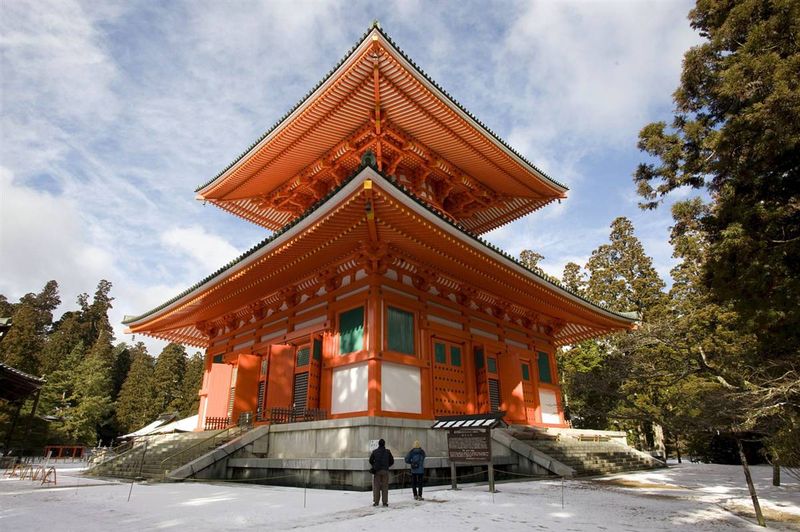
24) Kompon-daito Buddhist pagoda on Mount Koya, Wakayama Province, Japan. Mount Koya, located east of Osaka, was inscribed on the UNESCO World Heritage List in 2004. In 819, the first Buddhist monk Kukai, the founder of the Shingon school, a branch of Japanese Buddhism, settled here. (Everett Kennedy Brown/EPA)

25) Tibetan women walk around the Bodhnath Stupa in Kathmandu - one of the most ancient and revered Buddhist shrines. On the edges of the tower crowning it are depicted the “eyes of Buddha” inlaid with ivory. Kathmandu Valley, about 1300 m high, is a mountain valley and historical region of Nepal. There are many Buddhist and Hindu temples here, from the Boudhanath stupa to tiny street altars in the walls of houses. Locals say that 10 million Gods live in the Kathmandu Valley. The Kathmandu Valley was inscribed on the World Heritage List in 1979. (Paula Bronstein/Getty Images)

26) A bird flies over the Taj Mahal, a mausoleum-mosque located in the Indian city of Agra. It was built by order of the Mughal Emperor Shah Jahan in memory of his wife Mumtaz Mahal, who died in childbirth. The Taj Mahal was inscribed on the UNESCO World Heritage List in 1983. The architectural marvel was also named one of the "New Seven Wonders of the World" in 2007. (Tauseef Mustafa/AFP - Getty Images)

27) Located in north-east Wales, the 18-kilometre long Pontcysyllte Aqueduct is a feat of Industrial Revolution civil engineering, completed in the early years of the 19th century. Still in use more than 200 years after its opening, it is one of the busiest sections of the UK canal network, handling around 15,000 boats a year. In 2009, the Pontkysilte Aqueduct was listed as a UNESCO World Heritage Site as a "landmark in the history of civil engineering during the Industrial Revolution". This aqueduct is one of the unusual monuments to plumbers and plumbing (Christopher Furlong/Getty Images)

28) A herd of elk grazes in the meadows of Yellowstone National Park. Mount Holmes, to the left, and Mount Dome are visible in the background. In Yellowstone National Park, which occupies almost 900 thousand hectares, there are more than 10 thousand geysers and thermal springs. The park was included in the World Heritage program in 1978. (Kevork Djansezian/AP)

29) Cubans drive an old car along the Malecon promenade in Havana. UNESCO added Old Havana and its fortifications to the World Heritage List in 1982. Although Havana has expanded to a population of over 2 million, its old center retains an interesting mixture of Baroque and neoclassical monuments and homogeneous ensembles of private houses with arcades, balconies, wrought iron gates and courtyards. (Javier Galeano/AP)